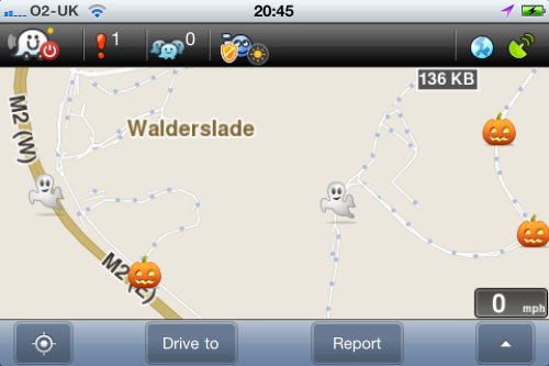
When driving around, Pete runs two sat navs – a TomTom, for the hardcore navigation, and a smartphone running Waze, the social navigation application.
Waze is a global project to create a free and fun sat nav. The software is available for a range of smartphones. Install it, and as you’re driving around, you update the master Waze map. You can report speed cameras and live travel news, and road speed information is shared when speed drops below a set threshold.
There’s also an element of fun and social interaction with Waze too – as you drive, you “munch” roads, to confirm them, and there are a bunch of goodies on the road to collect. You can also work your way up a scoreboard, and “ping” other Waze road users.
With Halloween upon us, the creatives at Waze are having fun with us – and there are now bonus ghosts and pumpkins dotted around the roads to help those collecting points to ramp up their scores.

Got Waze? If so, let us know. Otherwise, if you’ve got an iPhone, Android phone or a Blackberry – get the free app from waze.com (iPhone link). You’ll be addicted, and be doing your bit to map the world.
So, Waze are encouraging drivers to make unnecessary detours in the interest of gaining bonus points, woohoo.
With every extra mile travelled they use up more fuel, generate more emissions, increase congestion, increase the risk of accidents, increase the wear and tear on their own vehicle, and get a little bit lazier and fatter.
Way to go, Waze. Have a look at http://www.openstreetmap.org/ for a better way.
Carl? Is that you? Get back in the studio, immediately!