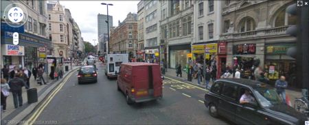
 Over the last 24 hours, Google has completed a major rollout of new Google Maps Street View data.
When the service launched in 2009, only roads in major cities were covered, but in today’s update, it seems that around 95 per cent of homes across England, Ireland, Scotland and Wales are now covered in high resolution. Apparently a quarter of a million UK roads are now covered.
The launch of the service last year raised a number of privacy concerns, and with this new data appearing, we can expect the second wave of this, as people see faces where they shouldn’t be, un-blurred car number plates, and people doing daft things.
Take a look at maps.google.co.uk – enter a UK address or postcode to see what was captured when the Google camera van visited your road. Drag the little orange person onto your target location and have a look around.

Found something funny? Let us know?
How do I go about removing my house from Googles street view?